
Locating
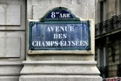
Paris is divided into 20 large administrative districts called arrondissements. Beginning at the center of the city, these curl round in a clockwise direction like a snail shell. A quick look at the street signs will tell you the arrondissement.
The Seine (pronounced “SEN”) River cuts across the arrondissements and through the historical heart of Paris. The river flows from east to west dividing northern Paris (the right bank) from southern Paris (the left bank) and includes 2 islands: Ile de la Cité and Ile Saint-Louis. Walks along the Seine include key sights in Paris like Notre-Dame, the Louvre, Concorde, the Champs-Élysées, and the Eiffel Tower.

The numbering of the arrondissements begins near the Louvre and ends with the neighborhood surrounding Père Lachaise Cemetery.
Look up!
That “8me Arr” atop the sign means you’re in the 8th Arrondissement of Paris. Look up when you’re walking to see these signs posted one-story up on buildings at every street corner.